
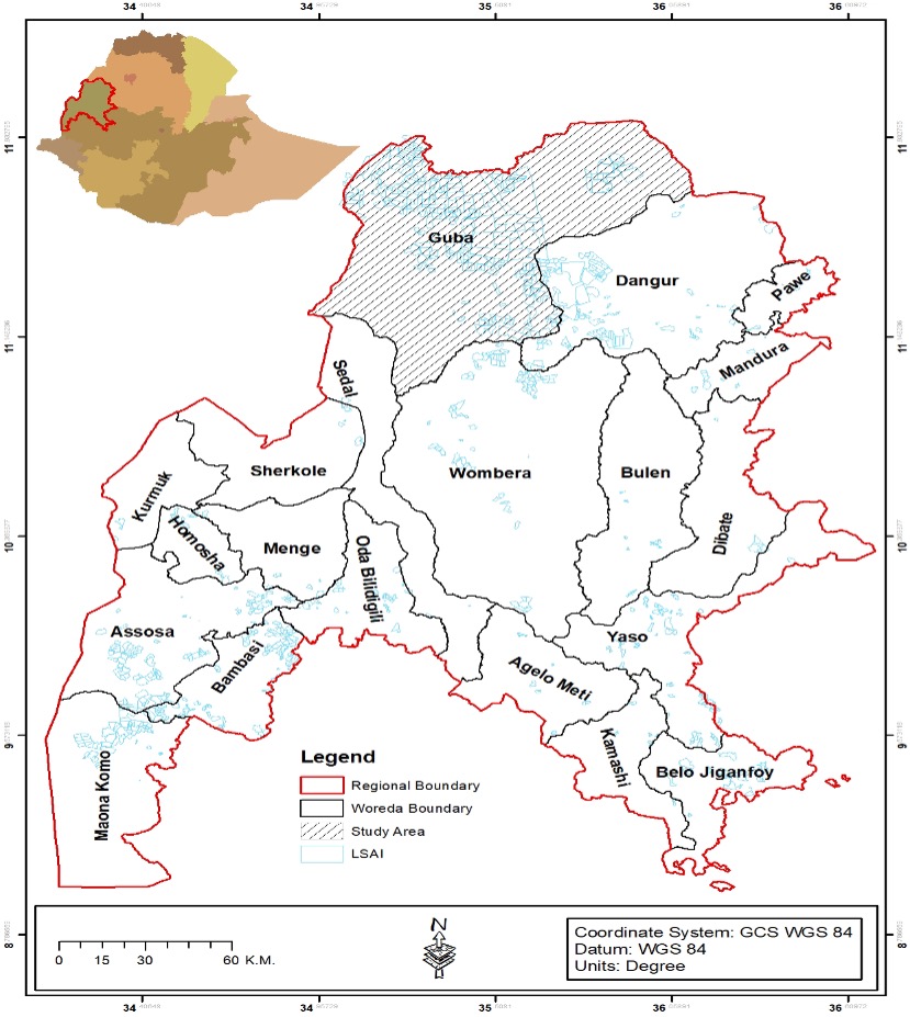
Large-scale Commercial Agricultural Investment: Implications for Land Use/Land Cover Dynamics in Guba District, Northwest Ethiopia
Published 2024-12-29
Keywords
- Land use,
- land cover,
- Large-scale commercial agricultural investment,
- Northwest Ethiopia
How to Cite
Copyright (c) 2024 Temesegen Disassa Marru, Tebarek Lika Megento , Amsalu Bedemo Beyene

This work is licensed under a Creative Commons Attribution 4.0 International License.


Abstract
Large-Scale Commercial Agricultural Investment (LSCAI) is expected to improve the living conditions of host communities while ensuring the productive use of natural resources. However, its impact on the local environment and land use/land cover (LULC) dynamics was not well investigated in Guba District, northwest Ethiopia. This study aimed to examine the implications of LSCAI projects on LULC change dynamics. To achieve this, the study employed a concurrent triangulation design, combining of qualitative and quantitative data. Data for the study were collected from primary and secondary sources, including satellite images with ground verification. The LULC map was prepared and image classification conducted by employing Arc GIS10.5 and ERDAS 2014. Structured interviews were conducted with 351 households, and unstructured in-depth interviews were conducted with key informants. The study revealed a significant increase in LULC over time. Dense forest cover decreased by 0.61% and open woodlands decreased by 1.25% per year. In contrast, cropland expanded by 1.79% per year between 1990 and 2019. Particularly, between 2010 and 2019, the rate of cropland expansion reached 3.25% per year due to the influx of LSCAI projects. This indicates that the expansion of LSCAI projects has nearly doubled the rate of LULC change in the study area. During the key informant interviews, it was confirmed that the period from 2010 to 2019 witnessed substantial expansion of LSCAI projects in the study area. Local communities also expressed concerns about the potential threats posed by LSCAI, including deforestation, land dispossession, malpractices, violent conflicts, and increased charcoal production. The main drivers of severe LULC are anthropogenic factors that promote the expansion of LSCAI. It is recommended that in the process of LSCAI, land identification and transfer to developers should be done in consultation with local communities, and the policy direction on natural resource utilization should be revisited to ensure the most sustainable use of land resources.
References
- Abdul-Hammed, A. N., & Mahdi, A. S. (2022). Monitoring Vegetation Area in Baghdad Using Normalized Difference Vegetation Index. Iraqi Journal of Science, 1394-1401. DOI: https://doi.org/10.24996/ijs.2022.63.3.40
- Babiso, B., Toma, S., & Bajigo, A. (2016). Land use/land cover dynamics and its implication on sustainable land management in Wallecha watershed, southern Ethiopia. Global Journal of Science Frontier Research: H Environment & Earth Science, 16(4), 49-53.
- Basha, U. I., Suresh, U., Raju, G. S., Rajasekhar, M., Veeraswamy, G., & Balaji, E. (2018). Landuse and landcover analysis using remote sensing and GIS: a case study in Somavathi River, Anantapur District, Andhra Pradesh, India. Nature Environment and Pollution Technology, 17(3), 1029-1033.
- Bekele, M. S. (2016). Economic and agricultural transformation through large-scale farming: impacts of large-scale farming on local economic development, household food security and the environment in Ethiopia. University Leide (PhD thesis).
- Bessie, S., Beyene, F., Hundie, B., Goshu, D., & Mulatu, Y. (2016). Land use/land cover change and its effects on bamboo forest in Benishangul-Gumuz region, Ethiopia. International Journal of Sustainable Development and World Policy, 5(1), 1-11 DOI: https://doi.org/10.18488/journal.26/2016.5.1/26.1.1.11
- Benishangul-Gumuz Region Bureau of Finance and economic Development (BGRBoFED) (2021). Map of Ethiopia Locating Benishangul-Gumuz Region and the Study area. (Unpublished), Assosa, Ethiopia.
- Bewket, W., & Abebe, S. (2013). Land-use and land-cover change and its environmental implications in a tropical highland watershed, Ethiopia. International journal of environmental studies, 70(1), 126-139. DOI: https://doi.org/10.1080/00207233.2012.755765
- Claverie, M., Ju, J., Masek, J. G., Dungan, J. L., Vermote, E. F., Roger, J. C., ... & Justice, C. (2018). The Harmonized Landsat and Sentinel-2 surface reflectance data set. Remote sensing of environment, 219, 145-161. DOI: https://doi.org/10.1016/j.rse.2018.09.002
- Gashaw, T., Bantider, A., & Mahari, A. (2014). Evaluations of land use/land cover changes and land degradation in Dera District, Ethiopia: GIS and remote sensing-based analysis. International Journal of Scientific Research in Environmental Sciences, 2(6), 199. DOI: https://doi.org/10.12983/ijsres-2014-p0199-0208
- Gebreselassie, S., Kirui, O. K., & Mirzabaev, A. (2016). Economics of land degradation and improvement in Ethiopia. Economics of land degradation and improvement–a global assessment for sustainable development, 401-430. DOI: https://doi.org/10.1007/978-3-319-19168-3_14
- German, L., Schoneveld, G., &Mwangi, E. (2013). Contemporary processes of large-scale land acquisition in Sub-Saharan Africa: legal deficiency or elite capture of the rule of law? World Development, 48, 1-18. DOI: https://doi.org/10.1016/j.worlddev.2013.03.006
- GIZ. (2018). Assessment of landscape transformation and its implication in Benishangul-Gumuz Region: to support responsible agricultural investment in Ethiopia (Unpublished).
- Guyu, D. F., & Aduwa, T. A. (2020). Land Use Land Cover (LULC) Change Detection Using Geospatial Technique in Anbessa Forest, Benishangul-Gumuz Region, Ethiopia. DOI: https://doi.org/10.21203/rs.3.rs-29693/v1
- Guyalo, A. K., Alemu, E. A., & Degaga, D. T. (2022). Impact of large-scale agricultural investments on the food security status of local community in Gambella region, Ethiopia. Agriculture & Food Security, 11(1), 43. DOI: https://doi.org/10.1186/s40066-022-00381-6
- Kattimani, J. M., & Prasad, T. R. (2015). Normalized Difference Vegetation Index (NDVI) Applications in Part of South-Eastern Dry Agro-Climatic Zones of Karnataka Using Remote Sensing and GIS. International Journal, 3(12), 1593-1596.
- Keeley, J., Seide, W. M., Eid, A., & Lokeley, A. (2019). Large-scale land investment in Ethiopia: How much land is being allocated, and features and outcomes of investments to date. Gates Open Res, 3(1409), 1409.
- Kindu, M., Schneider, T., Teketay, D., & Knoke, T. (2015). Drivers of land use/land cover changes in the Munessa-Shashemene landscape of the south-central highlands of Ethiopia. Environmental monitoring and assessment, 187(7), 1-17. DOI: https://doi.org/10.1007/s10661-015-4671-7
- Leul, Y., Assen, M., Legass, A., Damene, S., & Budds, J. (2023). Land use/cover dynamics and its drivers in Gelda catchment, Lake Tana watershed, Ethiopia. Environmental Systems Research, 6(1), 1-13. DOI: https://doi.org/10.1186/s40068-017-0081-x
- Marru, T. D., & Weldegebriel, S. K. (2021). Policy Response on Land Degradation Induced by Large-scale Commercial Farming in Benishangul-Gumuz Region, North Western Ethiopia. Policy, 12(18).
- Mishra, A., Karwariya, S., & Goyal, S. (2012). Land use/Land cover Mapping of Chhatarpur District, Madhya Pradesh, India Using Unsupervised Classification Technique. IOSR Journal of Engineering, 2(10), 51-56. DOI: https://doi.org/10.9790/3021-021055156
- Ministry of Agriculture and Rural Development (MoARD).(2009). Review of Agricultural investment potential in Ethiopia (Unpublished), Addis Ababa, Ethiopia.
- Ministry of Environment, forest and Climate Change (MoEFCC). (2016).Land use and land cover classification in Ethiopia (Unpublished), Addis Ababa, Ethiopia.
- Moreda, T. (2016). The political economy of the land-livelihoods nexus in an era of ecological change and the global land rush: access to land, land conflict, and large-scale land acquisitions in Ethiopia.
- Moreda, T. (2017). Large-scale land acquisitions, state authority, and indigenous local communities: insights from Ethiopia. Third World Quarterly, 38(3), 698-716. DOI: https://doi.org/10.1080/01436597.2016.1191941
- Müller, M. F., Penny, G., Niles, M. T., Ricciardi, V., Chiarelli, D. D., Davis, K. F., ... & Mueller, N. D. (2021). Impact of transnational land acquisitions on local food security and dietary diversity. Proceedings of the National Academy of Sciences, 118(4). DOI: https://doi.org/10.1073/pnas.2020535118
- Muluneh, A., & Arnalds, O. (2011). Synthesis of research on land use and land cover dynamics in the Ethiopian highlands. Unpublished thesis. Hawassa University, Reykjavik, Iceland
- Mundia, C. N., & Aniya, M. (2005). Analysis of land use and land cover changes and urban expansion of Nairobi city using remote sensing and GIS. International Journal of Remote sensing, 26(13), 2831-2849. DOI: https://doi.org/10.1080/01431160500117865
- Mundia, C. N., & Aniya, M. (2006). Dynamics of land use and land cover changes and degradation of Nairobi City, Kenya. Land Degradation & Development, 17(1), 97-108. DOI: https://doi.org/10.1002/ldr.702
- Mwathi, P. M. (2016). Effects of land use and land cover dynamics on the environmental quality of Nairobi city and its environs (Doctoral dissertation, University of Nairobi).
- Portes, A., & Walton, J. (2013). Labor, class, and the international system. Elsevier
- Sassen, S. (1990). The mobility of labor and capital: A study in international investment and labor flow. Cambridge University Press.
- Schneeberger, N., Bürgi, M., & Kienast, P. F. (2007). Rates of landscape change at the northern fringe of the Swiss Alps: historical and recent tendencies. Landscape and Urban Planning, 80(1-2), 127-136. DOI: https://doi.org/10.1016/j.landurbplan.2006.06.006
- Singh, B. M., Komal, C., & Victorovich, K. A. (2020). Crop growth monitoring through Sentinel and Landsat data based NDVI time-series. Компьютерная оптика, 44(3), 409-419. DOI: https://doi.org/10.18287/2412-6179-CO-635
- Singh, P., & Javeed, O. (2021). NDVI based assessment of land cover changes using remote sensing and GIS (A case study of Srinagar district, Kashmir). Sustainability, Agri, Food and Environmental Research, 9(4), 491-504 DOI: https://doi.org/10.7770/safer-V0N0-art2174
- Sothe, C., Almeida, C. M. D., Liesenberg, V., & Schimalski, M. B. (2017). Evaluating Sentinel-2 and Landsat-8 data to map sucessional forest stages in a subtropical forest in Southern Brazil. Remote Sensing, 9(8), 838. DOI: https://doi.org/10.3390/rs9080838
- Teklemariam, D., Azadi, H., Nyssen, J., Haile, M., & Witlox, F. (2016). How sustainable is transnational farmland acquisition in Ethiopia? Lessons learned from the Benishangul-Gumuz Region. Sustainability, 8(3), 213. DOI: https://doi.org/10.3390/su8030213
- Temesgen, D., Yehualashet, H., & Rajan, D. S. (2014). Climate change adaptations of smallholder farmers in South Eastern Ethiopia. Journal of Agricultural Extension and Rural Development, 6(11), 354-366.
- Temesgen, H., Wu, W., Legesse, A., & Yirsaw, E. (2021). Modeling and prediction of effects of land use change in an agroforestry dominated southeastern Rift-Valley escarpment of Ethiopia. Remote Sensing Applications: Society and Environment, 21, 100469. DOI: https://doi.org/10.1016/j.rsase.2021.100469
- Tolessa, T., Dechassa, C., Simane, B., Alamerew, B., & Kidane, M. (2020). Land use/land cover dynamics in response to various driving forces in Didessa sub-basin, Ethiopia. GeoJournal, 85, 747-760. DOI: https://doi.org/10.1007/s10708-019-09990-4
- Worku, G., Bantider, A., & Temesgen, H. (2014). Land use and land cover change in Ameleke Watershed, South Ethiopia. Journal of Natural Sciences Research, 4(14), 42-47.
- Woyessa, M. (2016). Land Acquisition for Commercial Agriculture in BGR, Ethiopia: Access, Utilization, and Impacts on Local Communities. Ph.D. Dissertation, AAU Sociology Departement, Addis Ababa, Ethiopia.
- Yesuph, A. Y., & Dagnew, A. B. (2019). Land use/cover spatiotemporal dynamics, driving forces and implications at the Beshillo catchment of the Blue Nile Basin, North Eastern Highlands of Ethiopia. Environmental Systems Research, 8(1), 1-30. DOI: https://doi.org/10.1186/s40068-019-0148-y